+6012-560 7479
plgofficial12@gmail.com
Level 2, Block C05, Faculty of Built Environment & Surveying, Universiti Teknologi Malaysia, 81310 Johor Bahru, Johor
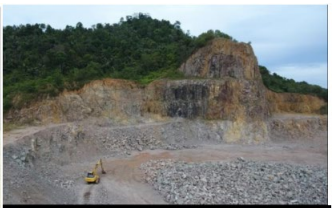
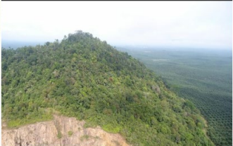
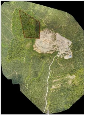
Photo Laser Grammetry Sdn Bhd was appointed by Perbadanan Setiausaha Kerajaan Johor to conduct a UAV mapping project for quarry volume estimation at Paloh, Johor.
The project utilised a fixed-wing UAV platform to capture high-resolution aerial imagery of the quarry site. The collected data was processed using photogrammetry techniques to generate accurate digital terrain models and volume calculations.
This project served as a proof-of-concept study demonstrating the effectiveness of UAV mapping technology for quarry monitoring and resource estimation.