About Us
- Home
- About
About Company
About Photo Laser Grammetry Sdn Bhd
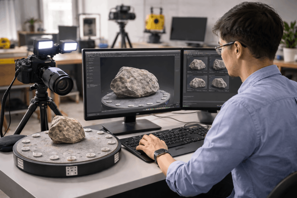
Photo Laser Grammetry Sdn Bhd (PLG) is a geospatial technology company specializing in photogrammetry, LiDAR mapping, laser scanning, and geospatial data solutions. As a Universiti Teknologi Malaysia (UTM) spin-off company, PLG focuses on bridging research innovation with real-world industry applications.
Our expertise includes professional geospatial services, specialized training programs, product development, and research and development in advanced mapping technologies.
Through continuous innovation and collaboration with industry partners, PLG aims to provide high-quality, accurate, and reliable geospatial solutions across multiple sectors.
Our Vision
To be a leading global geospatial mapping solution provider.
Our Motto
Precise • Accurate • Rapid
Brief History
Our Journey
2011
The Beginning
Photo Laser Grammetry Sdn Bhd was established on 12 April 2011 as a spin-off company of Universiti Teknologi Malaysia (UTM) through the Symbiosis Program initiated by the Malaysian Technology Development Corporation (MTDC). The company initially focused on commercialising surveillance technologies developed through university research.
2015
Expansion of Expertise
PLG expanded its capabilities into professional services and training in photogrammetry and 3D laser scanning technologies. The company began providing specialised geospatial services to industry clients while continuing its research and development activities.
Today
Innovation & Industry Collaboration
PLG provides advanced geospatial mapping solutions, including UAV photogrammetry, LiDAR mapping, laser scanning, hydrographic surveying, bathymetry, and GIS solutions.
For professional courses, PLG collaborates with government agencies, universities, and industry partners to support geospatial and marine mapping development. PLG provides the UTM Hydrography Programmes that comprises four (4) modules namely UTM HYDRO I (Category B), UTM HYDRO II (Category A), UTM HYDRO III (Category A), and UTM CARTO I (Category B), recognised by the International Board on Standards of Competence for Hydrographic Surveyors and Nautical Cartographers (IBSC). The IBSC operates under three international bodies: the International Federation of Surveyors (FIG), the International Hydrographic Organization (IHO), and the International Cartographic Association (ICA), which support global standards in surveying, hydrography, and cartography.
The module designs are based on IBSC standards, with implementation supported by UTM’s expertise and relevant agencies such as National Hydrographic Centre, Land Surveyors Board Malaysia, Association of Authorised Land Surveyors Malaysia, and Department of Surveying and Mapping Malaysia. These programmes are designed for marine and hydrography profesionals such as cartographers, hydrographic surveyors, oil and gas engineers, freelance surveyors, and licensed surveyors.
Recognised by IBSC, these are the only accredited programmes of their kind in Southeast Asia/Asia, offering strong local and international market potential. They develop competent, creative, and innovative professionals in hydrography and cartography through practical training in marine geospatial products, supporting accurate mapping, spatial data, infrastructure planning, and industry development.
Our Team
Our Expert Team
Sr Dr. Mohd Farid bin Mohd Ariff
Chief Executive Officer
Field of Expertise
- Close Range Photogrammetry (CRP)
- Structure-from-Motion (SfM) Photogrammetry
- 3D Laser Scanning
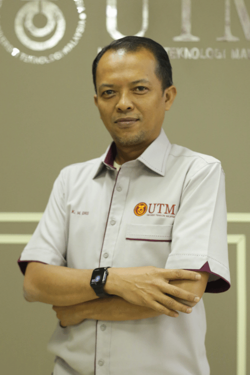
Sr Dr. Khairulnizam bin M. Idris
Project Director
Field of Expertise
- Industrial Surveying
- Deformation Surveying
- LiDAR Mapping
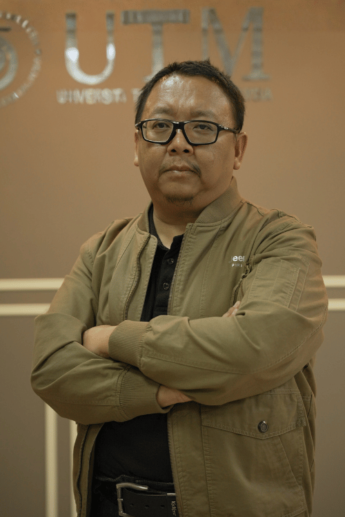
Prof. Gs. Dr. Zulkepli bin Majid
Technical Director
Field of Expertise
- Surveying Science & Geomatics

Sr Dr. Norhadija binti Darwin
Research & Development Director
Field of Expertise
- UAV Photogrammetry
- Geomatics Engineering
- Engineering Surveying
Dr. Hamdi bin Abdul Hamid
Administrative & Finance Manager
Field of Expertise
- Valuation
- Property Management
- Facilities Management
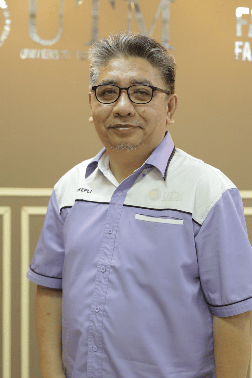
Sr Dr. Ahmad Razali bin Yusoff
Technical & Operation Executive
Field of Expertise
- Civil Engineering Survey
- Deformation Monitoring Survey
- UAV LiDAR & Photogrammetry Mapping
Mr. Ahmad Firdaus bin Razali
Survey Engineer
Field of Expertise
- Geomatics Engineering
- Photogrammetry & Laser Scanning